Mostrando entradas con la etiqueta chamje. Mostrar todas las entradas

martes, 5 de julio de 2016

ANNAPURNA CIRCUIT ETAPA 2: CHAMJE (1430 m) - DANAKYU (2190 m)

Click here to read the English version


Empezamos el día despidiéndonos de Purna y su familia después de desayunar pan tibetano con miel, que deberá darnos toda la energía que necesitemos hasta la hora de cenar. Y es que la rutina alimenticia senderista qua adoptamos fue de desayuno potente en azúcar y cena a base de pasta o arroz con verduras, hacer una pausa para comer estaba fuera de la ecuación (evidentemente llevábamos galletas por si a alguien le entraba el gusanillo). 


A Nepal fuimos a caminar no a comer, aunque hay que decir que saben cocinar (el Dal Bhat y los momos fueron nuestros favoritos).


Durante los días de calor tropical bebíamos entre 3 y 4 litros de agua por persona (y no había que parar a hacer pipí porque sudábamos todo lo que bebíamos). Para obtener agua durante el circuito hay varias opciones. La primera y más sencilla es bajar al río intentando no despeñarse y beber directamente de ahí. Esta opción es arriesgada porque 1) no es fácil llegar al río, 2) en caso de llegar al río de una pieza luego hay que volver a subir y 3) el agua está llena de sedimentos “naturales” como polvo glaciar y otros de naturaleza algo más orgánica por lo que las probabilidades de pillar una diarrea histórica son extremadamente elevadas. 


Desechada esta opción nos queda comprar agua embotellada (botellas de plástico de 1 litro de capacidad a precio de vino tinto) teniendo en cuenta que algo habrá que hacer luego con la botella (siendo educados nos referiremos al sistema de gestión de residuos nepalí como terrible) o rellenar la camelback. 


Para hacer lo que se conoce como “water refill” hay tres opciones: utilizar el agua procedente de los grifos públicos, donde el agua se filtra con lo que parece un calcetín sudado dado de sí de tanto usarlo, comprar agua más o menos hervida en una teahouse o utilizar una “safe water drinking station”. Esta última opción era nuestra favorita y es que es un proyecto financiado por Nueva Zelanda con el que han dotado a diversos pueblos del circuito de miniestaciones potabilizadoras de agua gestionadas por mujeres: de esta manera proveen agua limpia a un precio razonable y dan “poder” a las mujeres de la zona.


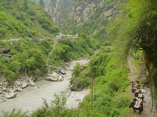
Después de esta pequeña divagación vamos ya a lo que es la segunda etapa del circuito. El calor era de los que hacen historia y el camino seguía el curso del río por la ribera opuesta a la carretera.


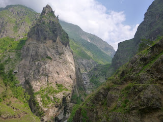
Caminamos rodeados de marihuana subiendo y bajando colinas donde de vez en cuando nos íbamos encontrando algún asentamiento agrícola (maíz y arroz principalmente) a través de un desfiladero que quitaba el hipo. Íbamos con cuidado impresionados por la verticalidad del acantilado que teníamos siempre a nuestra izquierda hasta que nos percataos de que la carretera estaba al otro lado del río y de que no debía estar en mejores condiciones que el sendero que íbamos siguiendo nosotros. Y entonces vimos pasar a un camión. 

El conductor de aquel camión se convirtió automáticamente en nuestro nuevo héroe de cabecera. Qué sangre más fría. Qué nervios de acero. Iba por la carretera y en más de una ocasión vimos como las ruedas del lado que daba al acantilado prácticamente colgaban. Esa persona debe perder un año de vida cada vez que conduce esa carretera. Y vino un jeep en sentido contrario: lucha de titanes. Seguimos caminando antes de que nos saliesen más canas y entonces vimos monos cruzando nuestro camino, probablemente colocados de hachís ya que no iban muy derechos.


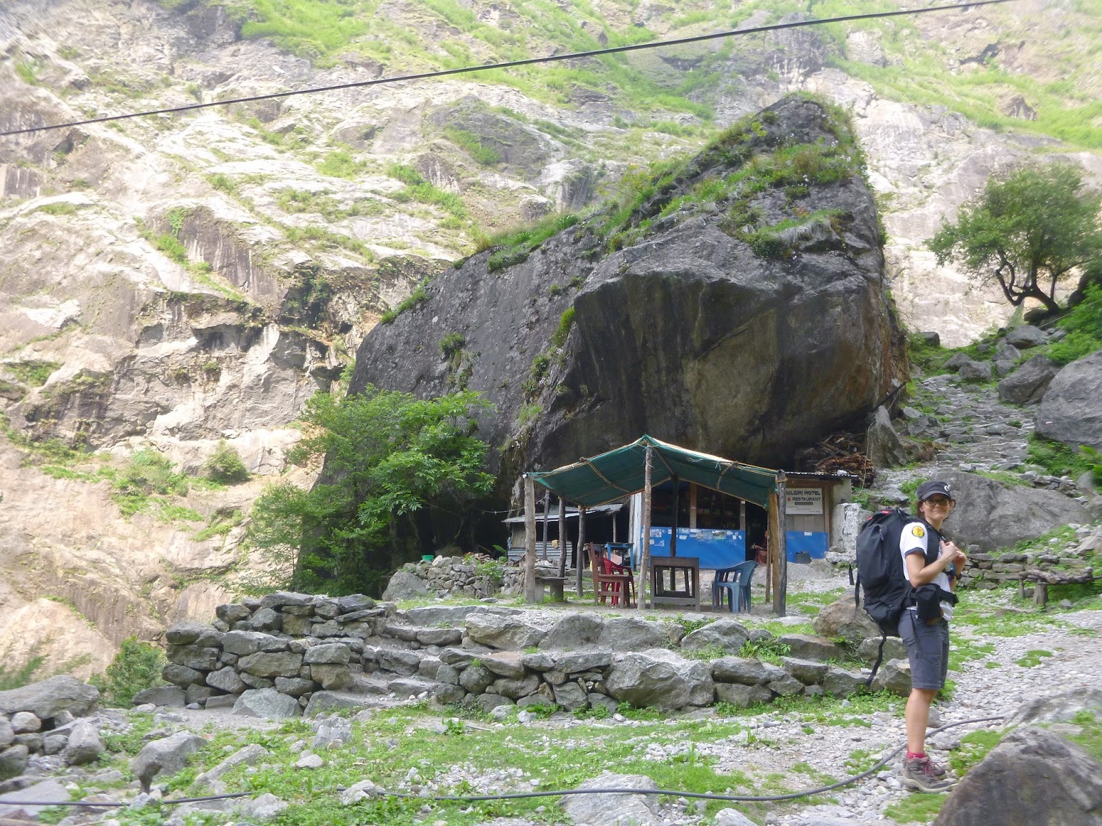
Seguimos caminando por lo que en el mapa serio de la zona de los Annapurnas que tenemos aparece descrito como “long hot climb”, que en castellano sería “el Angliru en verano”, hasta que llegamos a la población de Tal. Resultó ser un pueblecito formado exclusivamente por teahouses por lo que nos imaginamos que en temporada alta es un final-inicio de etapa muy habitual.


Fue aquí donde estrenamos los ponchos que nos habíamos comprado en Kathmandu y que un par de semanas más tarde serían como nuestra segunda piel. Fue un chaparrón más molesto que intenso pero refrescó un poquito el ambiente.


De Tal fuimos hasta Dharapani donde pudimos rellenar nuestras camelbacks y desde allí llegamos hasta Danakyu por la carretera.


En Danakyu nos alojamos en la guesthouse de Shanti, una señora de 40 años que nos invitó a un té tibetano (agua, leche y sal) y que nos dijo que ella había pasado Thorung La (el gran hito del Annapurna Circuit, el mayor paso de montaña del mundo) vomitando y con un dolor de cabeza terrible (con un mal de altura de libro). Días después nos enteramos que ese es el estilo nepalí, evidentemente no recomendable.


RESUMEN DE LA ETAPA:

Fecha: 4 de junio de 2016
Hora y altitud de partida: 07:30 a 1430 m
Hora y altitud de llegada: 14:30 a 2190 m
Distancia: 16,3 km
Tipo de vía: Carretera rural/Camino 50/50
Climatología: Tropical 
Condiciones meteorológicas: Nublado por la mañana y lluvia a mediodía
Alojamiento: Hotel Snowland con cama gratis y lavabo compartido con agua caliente. 
Precio del Dal Bhat: 400 Rs

Enrique & Marina
English version

ANNAPURNA CIRCUIT DAY2: CHAMJE (1430 m) - DANAKYU (2190 m)


The day started with tibetan bread and honey that should gave us enough energy until dinner time. Our eating routine for the hiking days consisted in having a breakfast rich in sugars and carbs and then have pasta or rice with vegetables and sometimes egg for diner. We carried some snacks in case we needed some energy in the middle of the day and we constantly found eateries along the track as well. However, we don’t normally stop for a big meal when we’re out for in the mountain for the day and that’s what we still did in Nepal, too.


In addition, the food in Nepal is so good (Dhal bat and mo:mos were our favourites) that we would have eaten too much for lunch and walking uphill in the heat of the noon with a full stomach didn’t sound like a good idea.


On tropical zones we drank between 3 and 4 litres of water each and we weren’t even stopping for a wee because all that water was turned into sweat. Getting safe drinking water in the Himalayas is a big deal, but there’re a few options. The first one is really simple: get down to the river and fill up your bottle. And that’s the option for the brave ones for several reasons: 1) getting down to the river involves high chances of falling down a cliff or two 2) in case you make it save to the river, climbing back up will be a challenge even for Sir Edmund Hillary 3) the current will be strong and will possibly haul your bottle, your arm and maybe yourself 4) the water you’ll find in the river is going to be full of sediments such as powdered stone coming from the moraines, sand dragged at the middle part of the river, other bits of organic nature and consequently will be brown or grey or something in between. Therefore, get water from the river and, if you survive to drink it, your diarrhoea will get you into history. 


If you don’t want to risk to lose your life, go for option number 2: buy mineral water. They’re generally sold in 1L plastic bottles at the price of red wine. That’s the least environmentally friendly option since after you drink your water or refill your camelback those millions of empty bottles should be appropriately disposed and that’s something that just doesn’t happen in Nepal. It’s not only that the waste management in the country is weak but also local people is not used to separate or even keep their daily garbage until they get home or to a place where it can be properly left. 


If you want to be eco-friendly and also stay alive, there’re still some options left: 1) refill your water from a public tap which are generally covered with a filter that resembles an old sweaty sock and add some iodine pills that you’ll wisely bring over with you for the trek 2) buy a refill of cold boiled water from some of the teahouses that offer it or 3) use the “safe water drinking stations”. That last one is everyone’s favourite because it’s convenient, cheap and safe. This project is supported by the New Zealand development agency and consists in a series of little stations located along some villages on the way. The stalls are operated by local women and professionally checked every six months. This system not only reduces the environmental impact of the mountain tourism but also empowers the local women and supplies a reliable source of safe water for the whole community, not only the visitors. However, there're not too many of these stations or there're out of order or they're closed and sometimes you have to find water somewhere else. 


Getting back to the point, let’s focus on the second day on the track. The heat was to beat the records and the track again followed the river on the opposite bank of the road. 


The walked through wild marihuana fields, up and down hills. There were some little farming villages on the way with lots of rice and corn fields growing along a really impressive cliff. Our path followed the left edge of that cliff while the road, that was on the opposite and symmetric side, didn’t have a much better terrain to go pass and thus its conditions were probably not much better. Then we saw a truck. 


That truck driver instantly became our hero: super-cold-headed-lorry-driver-man. From the other side we could see the outer wheels nearly hanging more than once. That guy must lose a year of his life every time he does that drive. And then, when things couldn’t look any more difficult, a jeep came on the opposite direction. We had to stop looking because the situation was making us feel too tense and then we saw a couple of monkeys. 


We carried on walking what our map described as a “long hot climb” up to Tal where there were only teahouses. It must be a really common place to stop for the night during the high season since there’s so much accommodation, bakeries and restaurants, now all closed, of course.  


It was in Tal where we used the ponchos we bought in Kathmandu for the first time. That rain was  just a bit annoying rather intense but did the trick to cool the ambience down a bit. 


From Tal we made it to Dharapani where we filled our camelbacks in the safe drinking station and then to Danakyu walking on the road.


We choose to stay in Shanti’s guesthouse in Danakyu. Shanti is a 40 yo lady who invited us for Tibetan tea (made with water, milk and salt) and gave us several tips for the trail. She also told us about a time when she walked over Thorung La pass (the highlight of the AC) vomiting and with a strong headache so with severe altitude sickness. Eventually, we found out that this is the Nepali style of walking in altitude, obviously not advised. 

STAGE OVERVIEW:

Date: 4rd of June 2016
Start time and altitude: 07:30 @ 1430 m
Finish time and altitude: 14:30 @ 2190 m
Aprox distance: 16.3 km
Type of track: Rural road/track 50/50
Climate: Tropical 
Weather on the day: Sunny morning and cloudy after midday 
Accommodation: Hotel Snowland. Free comfy room and shared washroom with solar shower. 
Price of Dal Bhat: 400 Rs


Enrique & Marina

domingo, 3 de julio de 2016

ANNAPURNA CIRCUIT ETAPA 1: BHULBHULE (849 m) - CHAMJE (1430 m)

Click here to read the English version


La aventura del Annapurna Circuit comenzó realmente con la partida desde Kathmandu en el autobús “tourist only” que habíamos reservado el día anterior con la compañía Holiday Adventure de Thamel. Todos los autobuses eran “tourist only” y tenían “free wifi”, o al menos eso tenían escrito en el parabrisas. Al no tener smartphone o tablet lo del internet gratis a nosotros nos daba igual, pero hay gente que necesita internet igual que necesita el oxígeno para sobrevivir. Pobrecitos cuando descubrieron que en Nepal gustan de escribir cosas en inglés en los autobuses (free wifi, facebook, skype, fc barcelona…) sin que eso tenga ninguna implicación posterior. 


En fin que durante el prólogo del Annapurna Circuit fuimos de Kathmandu a Dhumre en bus “tourist only” (por 600 Rs/persona) y de Dhumre a Bhulbhule, gracias a las indicaciones de un adolescente colocado de pegamento, fuimos en autobús “de línea” (por 200 Rs/persona) del que no entraremos en detalles: quien ha estado en Asia sabe de lo que hablamos y quien no ha estado… bueno tampoco queremos quitarle las ganas de viajar. 


Una vez en Bhulbhule nos alojamos en la Everest Guest House donde, al ser nuestro primer contacto con el circuito, pagamos la novatada al negociar el precio. Y es que durante el resto de días de senderismo por el macizo de los Annapurnas, gracias a ser época de Monzón (temporada turística baja), tuvimos siempre las habitaciones gratis a cambio de desayunar y cenar donde nos alojábamos.


El Annapurna Circuit se abrió al turismo en 1977 y sigue la ruta comercial del area (parte de una de las múltiples rutas de la seda según algunos). Desde hace siglos la gente de la zona utiliza la ruta tanto para comerciar como para ir a visitar a la familia. Debido a la dureza del terreno la gente local solía dar té a los caminantes que veía a punto de echar los higadillos. Del té pasaron a ofrecer parte del Dal Bhat que tenían preparado (el Dal Bhat es arroz con lentejas y verduras al curry que es la piedra angular de la dieta nepalí) y a dejar a los caminantes un hueco para pasar la noche. 

De este modo fueron floreciendo los negocios de Teahouses (casas de té) a lo largo del circuito donde la costumbre dictaba que si los caminantes cenaban y desayunaban en tu establecimiento lo correcto y hospitalario era invitarles a pasar a noche a cubierto. Con la llegada del turismo la presencia de teahouses creció exponencialmente, habiendo incluso pueblos donde lo único que hay son hospederías, y se perdió un poco la ingenuidad y la hospitalidad características de la gente del Himalaya. Afortunadamente en temporada baja parece que se recuperan las viejas costumbres y la vida transcurre a un ritmo menos acelerado e impersonal.


El día 3 de junio a las 7 de la mañana nos pusimos la mochila al hombro, cruzamos el puente colgante que separa Bhulbhule en dos mitades y empezamos a caminar.


El recorrido comienza siguiendo la (odiada por los dueños de hostales y guest houses) nueva carretera permanentemente en construcción de Besi Sahar a Manang. Es un camino rural de grava con más cráteres que la luna, casi sin anchura suficiente para que dos monopatines circulen en paralelo (eso no impide adelantarse a los camiones) que parece ser está generando un flujo de excursionistas vaguetes que deciden saltarse el tramo de excursión hasta Manang (se ahorran entre 4 y 7 días de caminata) por lo que los dueños de guesthouses en en tramo previo a Manang están que trinan.


Estamos en la zona tropical de Nepal por lo que hacía un calor asfixiante y el camino transcurrió entre terrazas de arroz, plantaciones de maíz y plantas de marihuana creciendo por todas partes.


Al calor y la humedad hay que añadirle la constante presencia de camiones gigantescos que están trabajando en la construcción de una presa en la zona de Ngadi por lo que el primer par de horas de excursión se hizo bastante pesado.


Una vez dejamos atrás la presa (en la que han tenido a bien poner un cartel en el que piden muy educadamente a los trabajadores que no trabajen borrachos) nos dirigimos, por un camino que subía de forma muy empinada, hacia Bahundanda, un pueblecito situado en lo alto de una colina donde pudimos disfrutar de las primeras vistas del valle del río Marsyangdi.


Seguimos la carretera hasta que en Syange pudimos seguir el camino para excursionistas. Fue en este tramo donde conocimos a Stefan, un chico de Munich de 22 años que acabó acompañándonos hasta que abandonamos el país casi tres semanas más tarde. Como si fuese el Camino de Santiago, de ir en pareja habíamos pasado a ir en grupo ya en el primer día (en las dos semanas de caminata vimos a menos de 15 excursionistas cuando, por ejemplo, la media de caminantes en octubre es de más de 4000).


Ya bastante cansados seguimos caminando hasta que bajamos los brazos en Upper Chamje, después de una subida infernal a través de un bosque de ciruelos y limoneros, donde el señor Purna nos convenció para quedarnos en su hotel tibetano.


RESUMEN DE LA ETAPA:

Fecha: 3 de junio de 2016
Hora y altitud de partida: 07:00 a 849 m
Hora y altitud de llegada: 15:00 a 1430 m
Distancia: 22 km
Tipo de vía: Carretera rural/Camino 70/30
Climatología: Tropical 
Condiciones meteorológicas: Mañana soleada, nublado a partir de mediodía.
Alojamiento: Tibetan Hotel con cama gratis y lavabo compartido sin agua caliente. 
Precio del Dal Bhat: 400 Rs


Enrique & Marina

English version
ANNAPURNA CIRCUIT DAY 1: BHULBHULE (849 m) - CHAMJE (1430 m)


The real adventure already started when departing Kathmandu by the “tourist only” bus that we had booking at Thamel’s Holiday Adventure office. At the bus stop all the buses seem to be for “tourist only” and have “free wifi”, or that’s what their windscreens displayed. Since we didn’t have any devices that could get connected to the internet we couldn’t care less about it but some other travellers seem to depend on that as much as on the oxygen in the air we breath. I guess they all become really disappointed as they figure out that in Nepal they like to write random foreign words (free wifi, facebook, skype, FC Barcelona) on vehicles and that those words don’t necessarily involve any consequences or services.  


Summarising, this preface of the Annapurna Circuit includes the trip from KTM to Dhumre by “tourist only” bus (600 Rs ea) and from Dhumre to Bhulbhule on a regular coach that we found thanks to the directions that an underaged boy gave us despite not looking really reliable (200 Rs ea). We’re not going to step on the slippery ground of telling the type of bus that was, those that have travelled in Asia know what it could be like and if you don’t, we’re not going to be the reason to stop you from going there. 


In the afternoon, we made it to Bhulbhule and stayed in the Everest Guest House. The place wasn’t bad but we had our new guys’ blunder and overpaid for the stay. That was the only time we paid for the room in the whole trek around the Annapurnas. Note that it was monsoon season (June’s the month that holds the lowest record of trekkers) and we were probably the first tourists that stayed in the village in the last week or the last month. For that reason we managed not to pay for the rooms in the lodges where we’d have both dinner and breakfast.  


The Annapurna Circuit was opened to visitor in 1977 and follows one of the ancient commercial routes of the area which is said to be one of the several Silk Roads leading to India. The Nepali have been using this track for trading or visiting family living somewhere else for centuries. Considering the toughness of the region, the locals used to offer tea to the travellers struggling to get to see their relatives in still one piece. At that time they were also invited to have some Dal Bhat (the staple food in Nepal consisting in rice, Dal or lentil and turmeric sauce and vegetable curry that usually comes with popadoms and some pickled vegetables) and left to spend the night under some warm and safe shelter. 


Bearing in mind this need, little teahouses flourished along the way where walkers could get some food and hot tea and, afterwards, these guests will be kindly invited to spend the night under a roof since that’s what the traditional Nepali hospitality suggests it’s the right thing to do. With the boom of the tourism the number of teahouses grew dramatically and now there’re villages where there’re only lodges and not a single private house losing a little bit the authenticity and the genuine hospitality of the Himalayan culture. That’s why we think we were lucky enough to be there while no one else was and some good old ways were back in place. Life in the mountains seem to be quiet and peaceful and our hosts looked relaxed and happy to share some of their food, their homes and of course their knowledge and adventures with us. 


On the 3rd of June at 7 AM we fastened our backpack buckles, crossed the hanging bridge of Bhulbhule and started walking. 


The track starts following the controversial new and constantly under construction road that links Besi Sahar and Manang. Imagine that road as rural gravel path very unlevelled and just wide enough for two skateboards to ride one next to each other. Despite the rough conditions of the road, there’s a significant traffic flow of trucks and jeeps going up and down driving mostly tourists that skip walking the section up to Manang and, consequently, decrease the business for all the guesthouses located in that part of the circuit that can take between 4 and 7 days of trekking. 


This is the tropical region of Nepal and the heat was close to unbearable and the landscape featured long and steep rice terraces, corn fields and marihuana and tomatoes growing as the wild weeds. 


The heat and humidity were topped up with the constant flow of utes and machinery working on the Ngadi dam that the Chinese government is funding. You’ll understand that this part of the trail wasn’t particularly the most pleasant.


We left the dam behind (check this screen kindly asking the construction workers not to go drunk to work out!) and walked on a very steep track that led us to Bahundanda, a little town on top  of a hill where we enjoyed views of the Marsyangdi river and its valley for the first time. 


After, we followed the road up to Syange where we could get out of the road for a bit. Then it’s when we met Stefan, a 22 years old young man from Munich who ended up leaving Kathmandu with us after spending all our time in Nepal together. For those who have heard about “El Camino de Santiago”, the AC is in many ways similar: you start walking with your partner or alone but you find company within the first day. However, we counted only 15 trekkers over the 14 days of  trekking while in the average of people in the trail in October is about 4000. 


Fairly tired at this point of the afternoon, we still climbed through a forest with some wild plum and lemon threes scattered around up to Chamje  where Mr. Purna didn’t have to insist much to make us stay at his Tibetan Hotel located in Upper Chamje. 


STAGE OVERVIEW:

Date: 3rd of June 2016
Start time and altitude: 07:00 @ 849 m
Finish time and altitude: 15:00 @ 1430 m
Aprox distance: 22 km
Type of track: Rural road/track 70/30
Climate: Tropical 
Weather on the day: Sunny morning and cloudy after midday 
Accommodation: Tibetan Hotel. Free of charge very basic room with shared bathroom and no hot water. 
Price of Dal Bhat: 400 Rs

Enrique & Marina